What Cannot Be Unearthed
Pauses.
Awkward ones, hesitant ones, and uncomfortable ones before disagreements.
Pauses have filled my journey to trace kōdoku, or mine poison—toxicities originating from mines, in the Ashio-Watarase River basin. It is where Japan’s first major industrial-pollution disaster, the Ashio Copper Mine Pollution Incident, occurred, beginning with active mining in the 1870s and resurfacing in the 1950s.
In 2011, following the East Japan earthquake, a tailing dam in Ashio collapsed, releasing heavy-metal-laden residues into the 107-kilometer-long Watarase River, which runs across Tochigi, Gunma, Ibaraki, and Saitama prefectures in eastern Japan.
“Mine poison has not yet concluded,” wrote a local resident.
My journey began with this line. Starting from the headwaters surrounded by residue-containment facilities in Ashio, along the river course with its irrigation waterways and infrastructure, to the confluence, where a flood-retention basin turned from a toxic wasteland into a Ramsar wetland.
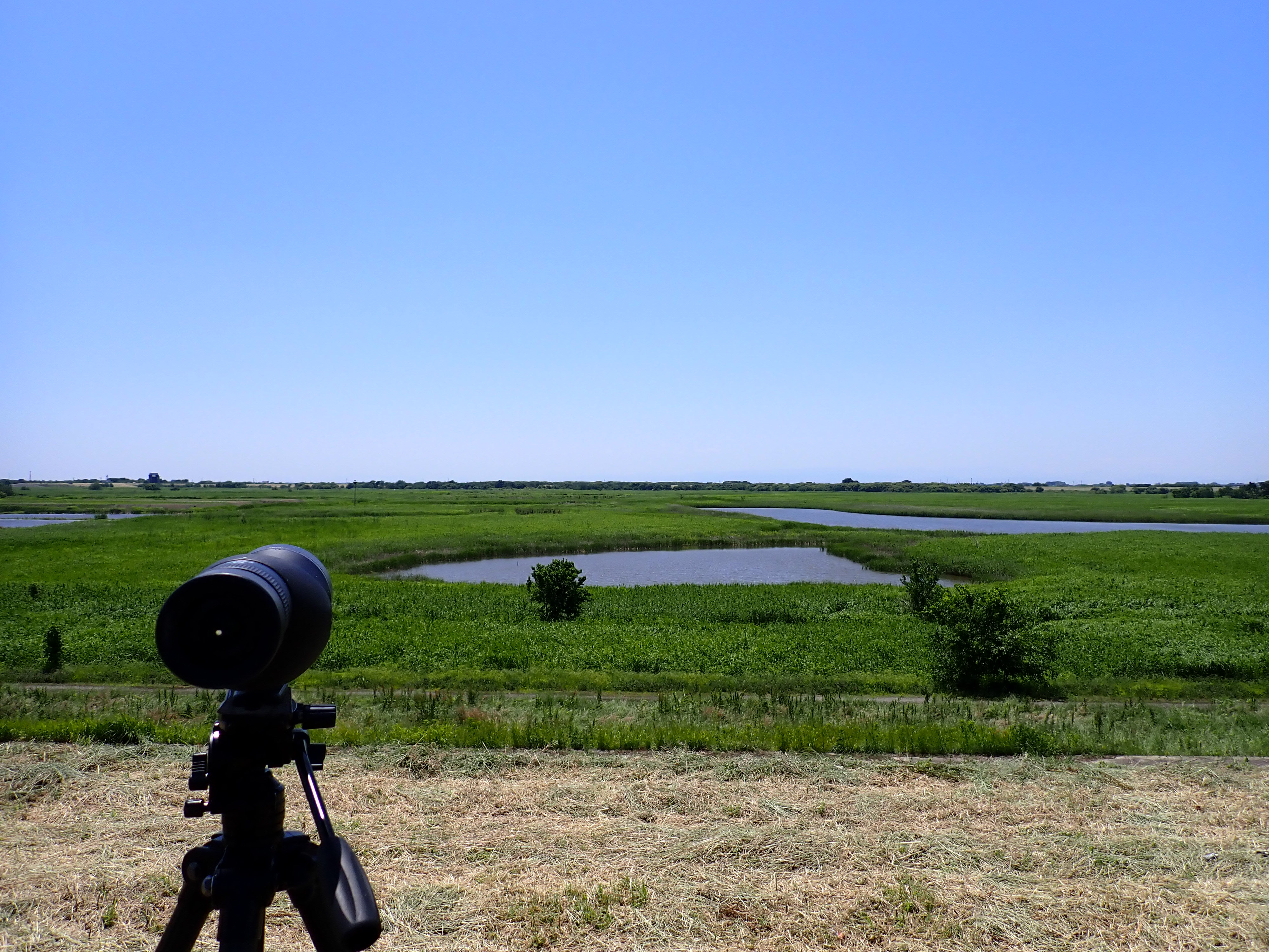
Flowing Mine Poison
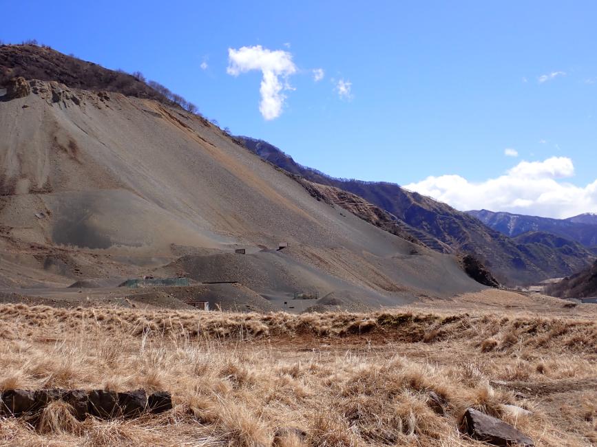
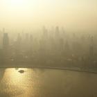
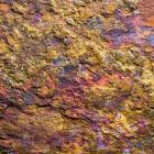
The Matsuki Tailing Dam, Ashio, Nikkō, Tochigi Prefecture, March 2024.
At the Matsuki Tailing Dam in the former copper-mining town of Ashio, black copper slag piles high on mountains, turning them into an open-pit disposal site. Back then, the surroundings were a village, also named Matsuki. Its tombstones can still be found amid pasture grass in this deserted land.
The village was abolished in 1902 when its land became unlivable due to pollution caused by the sulfurous, acidic gases emitted from the refining of sulfurous copper ores. The dumping of waste in the area began in 1912 and continued for nearly 50 years; the slag remains there to this day.
A volunteer reforestation group, comprising both residents of Ashio and those from downstream, began reforesting Ashio’s barren mountains in 1996. One volunteer I met there offered to drive me around. He pulled his car in front of the piles of black residue and said, “When it rains, mine poison is washed away and flows to the Watarase River, then to the Tone River.” I asked, “Does anyone know about the presence or do anything about it?”
Pause, “no,” another long pause.
It was the beginning of the many “noes” and pauses I encountered when I inquired if someone was affected by the pollution. There are lingering damages and harmful legacies, but it would also be diverging from the lived reality if one were to say the river is toxic.
I became deeply confused about what and where mine poison is. It can be the black residue piled up on the mountains, the surge in heavy-metal concentration in sampled water during typhoons, the farmlands that need to be restored after being flooded by mining residues, or the risk of residue leakage. Are these potential or present harms? The lines between are murky.
What surprised me most was when the volunteer mentioned the Tone River. The pollution is less perceived as a problem further to the east.
A century ago, in the 1900s, at the point where the Watarase River joins the Tone River, villages were evicted and their lands were taken away to build a reservoir that would prevent toxic runoff from reaching beyond.
This basin is one of the infrastructural pauses in the course of flowing mining poison, echoing the pause in our brief conversation.
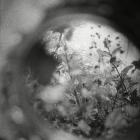
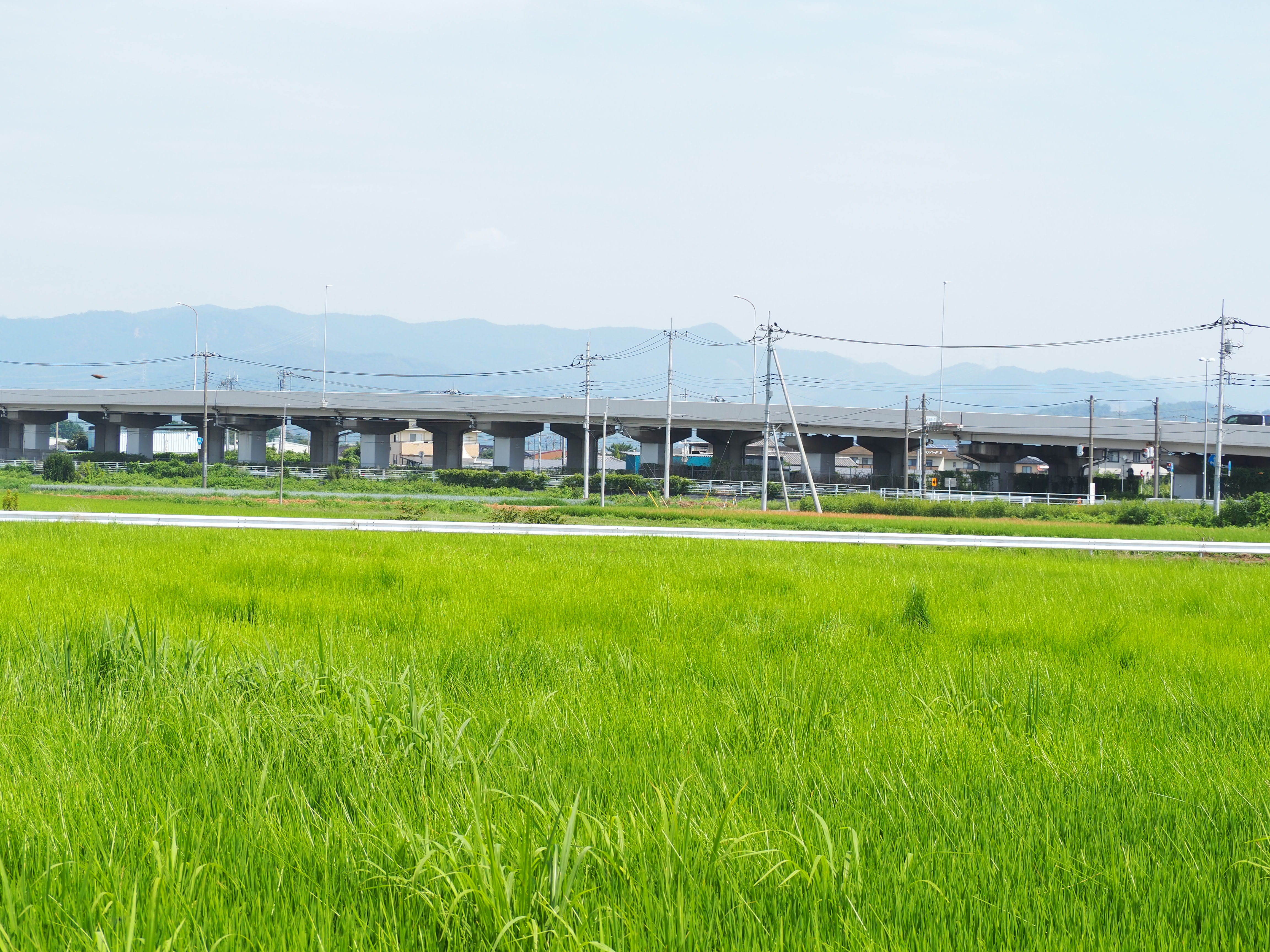
Above the Reeds

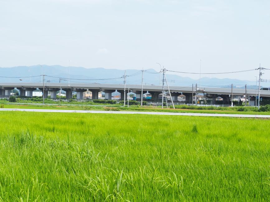
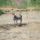
A section of the Watarase Retarding Basin, Oyama, Tochigi Prefecture.
The Watarase Retarding Basin was at first a vast land that revealed little vitality to me, as I was yet to learn to notice the wildlife inhabiting the land. As a flatland dam, it was far from pristine nature but paved with concrete, with its surroundings already developed into golf courses.
The transformation of the evicted villages’ farmlands into a retention basin has been a lengthy process and continues to this day. And so have the social movements rooted in this land continued even after the complete eviction of the Yanaka villagers who resisted until 1917.
Social movements after the eviction had not challenged the premise of the land as a retention basin. A shift in trajectory occurred in the 1990s when conservationist values led the movement against new leisure-development plans, connecting with the heritage-preservation movement led by Yanaka descendants since the 1970s.
This new wave challenged the idea of what the basin is and should be. In the English pamphlet written by the activists, the land is referred to as the Watarase Marsh, a reed wetland where many wildlife species live. They pushed for its designation as a Ramsar wetland and succeeded in 2012. Time has shifted from pollution to regeneration, some said to me. Still, notably, it was the year following the 2011 tailing-dam collapse in Ashio.
When I asked one of the leading figures of the movement about the pollution, she told me, like the volunteer did, that when it rains, mining residues are washed down from tailing dams, and overflow from the water-treatment plant neutralizes acidic mine drainage.
“Does mine poison affect the basin?” I asked.
My question was met with a contemplative pause. The leader pointed to a few places on the map and told me where mine poison was mostly buried. One of the hotspots is the Akama Swamp, which was filled up in the 1940s after Typhoon Kathleen.
The swamp was where enkomin, evicted villagers who were affiliated with the land, used to catch fish. They retained the right to use the land for activities such as fishing, sericulture, and harvesting reeds for screen making. There was once a vision to revive the swamp, but it was not fulfilled, and the reed-screen industry has also declined nowadays.
One time, on our way to clear weeds from the evicted Yanaka village’s common cemetery, a descendant of another displaced village said to me that the reeds were supposed to be pieces of farmland. She invited me to “think about it.” As her parents never discussed the political essence of the land, she only learned about its history after joining the antigolf-development movement to stop pesticide pollution. And now, she wanted to let people know that “It was a land people had lived in.”
I searched for the historical writings she suggested I read about and found that reeds were depicted as the ruins of farmlands destroyed by mine-poisoned floodwater.
This time, I paused.
I often feel that my questions about effects and impacts are bad questions, and they are just not to the point, but I also do not see other ways of asking about the presence of mine poison and what it does. Many other community members engaged in the conversation told me, each after a pause, that Oriental storks and Eastern marsh harriers fly above the reeds. However, reeds were historically associated with loss and grief, not celebration.
Mine poison is something not to be unearthed. And we have come to place our longing on what lives above the sediments.
While the environmental movement gained momentum in the 1990s, the basin had already garnered attention for its ecological value in the 1970s, as I learnt from a conservationist. It is also around the same period that the water quality of the Watarase River began to stabilize as a giant dam called Kusaki Dam was built between Ashio and the downstream area.
Sediments and Dams
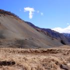
A highway cutting through farmlands in Morita District, Ota, Gunma Prefecture.
The Kusaki Dam is located a 15-kilometer straight-line distance from the Matsuki Tailing Dam and 45 kilometers from the Watarase Retarding Basin. Submerged under the dam are another displaced village, sections of the national road, and an abandoned railway.
At the bottom, there is also sedimented copper.
One time, I used the term “mine poison sedimentation pond” in referring to the dam, and a downstream resident was alerted and asked me, “Where did you learn about this term?”
He told me that the dam was a multifunction dam, and one of its functions was to sediment mine poison; yet, he disagreed with the naming of sedimentation pond. I was surprised, as he was one of the most persistent people in persuading others that the pollution was not resolved.
He took a hesitant pause before deciding to share with me his personal story. It was because of his deceased farmer brother. His brother told him that no farmer downstream would agree with this label. The water flow beyond the dam is used for irrigation. Saying the dam is a mine-poison pond implies that farmers are using toxic water.
Farmers’ words carry weight. They were the central actors in the earlier movements to halt copper-mine operations and demand reparations. The water-management co-op his brother worked for covers the village that had fought the mining company since pollution resurged when a tailing dam collapsed in 1958—the same one that collapsed again in 2011.
Historically, the term sedimentation pond referred to those carved at the entry of waterways in an attempt to slow down mine poison from pouring over the paddy fields. Tailing dams are sedimentation ponds, the resident said, and after another hesitant pause, added that the retarding basin was historically built for this purpose, too. However, he contended that the Kusaki Dam should not be referred to as such.
In the 1970s, another important event was that a settlement was made between some of the affected villages and the mining company, Furukawa Mining. It was the first time compensation was made in the name of compensation, rather than as a donation or subsidy, thereby convicting the corporation of complicity.
Yet, even after settlement, the incident will not end as long as mine drainage and residues remain.
Another downstream resident, whom I believe would instead agree with using “mine-poison sedimentation pond” in referring to the dam, brought me to an agricultural sedimentation pond. This pond, prior to reconstruction, was part of the measures to mitigate the impact of mine pollution on farmlands. Gradually, water facilities downstream were categorized for agricultural-irrigation use, separated from pollution-control infrastructure.
Here, what sedimented are sandy particles, not mine poison.
However, the activist told me he sensed the presence of mine poison here and it was the starting point where he decided to dig into the issue. I asked, feeling again it would be a bad question, “Is mine poison sedimented here then?”
He did not give me a direct answer but said that mine poison was diluted now.
After years of sedimentation, the boundary between pollution and safety is pushed upwards to the mountains in Ashio. From the corners of paddy fields to downstream mitigation facilities, the construction of the Kusaki Dam in the 1970s parted irrigation from mitigation.
It is an imperfect pause, a leaky chasm that held toxicity contained as something potential, partially, but enough for us to draw a line between toxicity below and livelihood above. Mine poison persists but is diluted as it passes the dam.
When driving by the highway that cuts through one of the villages that fought against the mining company, the activist told me the road was built before polluted soil was removed, so mine poison was right under it. Side by side, we saw from the car window that restored farmlands had been mostly converted into industrial warehouses. “What is restoration for if the land were to be turned into industrial parks?” he said to me.
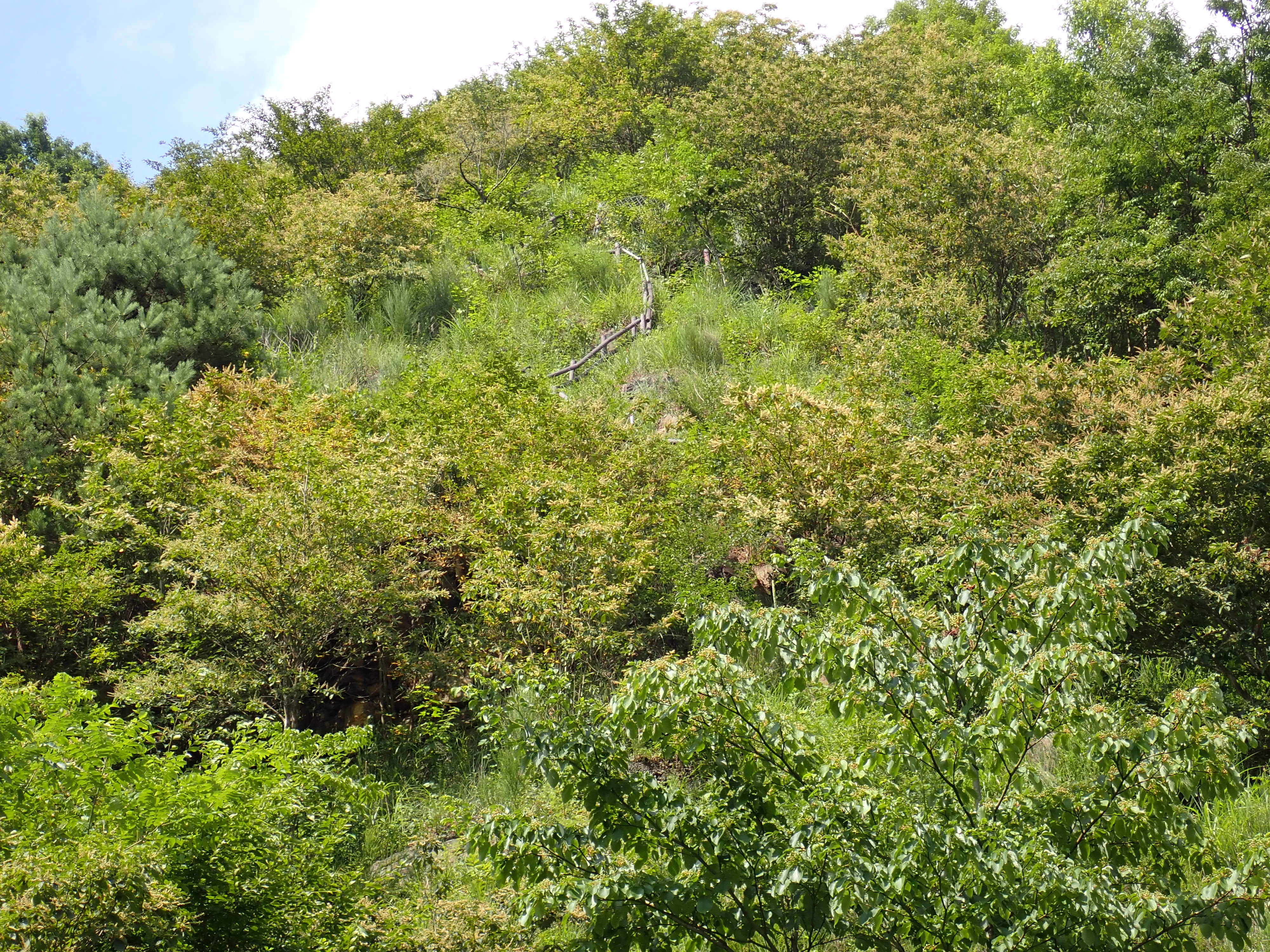
Unearthing Life

A staircase in the reforested Ōhatasawa Green Erosion Control Zone, Ashio, Tochigi Prefecture.
A staircase in the reforested Ōhatasawa Green Erosion Control Zone, Ashio, Tochigi Prefecture.
© Fung Wan Yin Kimberly. Used by permission.
The copyright holder reserves, or holds for their own use, all the rights provided by copyright law, such as distribution, performance, and creation of derivative works.
During a summer field trip to Ashio, visitors stopped in the middle of the road leading to the earlier area where residents in Ashio and volunteers from downstream joined hands to reforest. The road was broken, so we could only stare at it from afar.
There, a participant asked, “Why is Furukawa not doing anything about the barren mountains?” Furukawa, the mining company, continued copper mining until 1973 and refining until 1989 in Ashio.
The uncomfortable pause following this question reminded me of how much conflicts and tensions were suspended—not necessarily reconciled—before Ashio and the downstream area come together monthly for reforestation, and also, how farmers from downstream are reluctant to join as after all, it should not be them but the corporation who should restore the lands it has damaged.
These questions on irreparability are suspended, like the sediments contained in the Kusaki Dam.
In the 2000s, a blueprint was developed from the wetland-conservation initiative to reconnect the material cycle between Ashio and the downstream by using reeds as compost and mulch for reforestation. Sediments are not only poisonous but also nutritious. As pollutants, they flow from mountains to the wetland, but as nutrients, they may return to the eroded mountain through the reeds growing on them.
Looking at the broken roads, the circulation of reeds to the mountains may be an ideal that rewrote the socioecological realities less than it intended, but we also cannot completely measure or trace what it has elicited over the decades. As residue continues to leak, flow, and sediment, so do ants, and the sumire (violet) flower seeds they carry move across the human-cut platforms on slopes. Similarly, deer wander, biting off the bark of human-planted seedlings while leaving the toxic purple foxgloves alone.
Life sprouts from polluted and evicted lands, too.
And between toxicity and life, there are pauses.
Should the retarding basin be farmland or a wetland, and should the mountains be a revived town or forests? They are questions we do not ask, but only pause because of what lies beneath the grounds.
Beneath the ground, toxicity endures in the places where villages and their ecologies once stood. Some villages were abolished, while others were forcibly evicted. Some restored villages were redeveloped, and the dream to rebuild the evicted ones was lost when sediments were to be left buried.
Hoping for futures more than and beyond us becomes how we and our pasts may live, but we do so through fences and repellent nets, through gestures of deterring and weeding. Contradictory as it may seem, it creates pauseful spaces from the trajectory of abandonment. Within the nets, trees were kept alive instead of being eaten before they grew strong enough. Through cutting reeds and willows, ponds were carved out for insects and birds. Creating spaces for other beings becomes communities’ way to relate to lands whose histories have been erased by pollution and are now still marked by the sedimented mine poison.
It is in those pauseful spaces where what cannot be unearthed is revealed to us not as toxicities, but as fragmented grounds of soil to plant trees and as concrete-paved roads for communities to walk toward each other.
It has been over 100 years of pollution and evictions, and 50 years since the farmers’ settlement and mine closure. Where soil meets concrete, reeds grow in wasteland, and the river flows over sedimented residue, new ground is being formed and will continue to be formed. On appropriated lands where gates have been built. On land where communities can only access them by gaining permission from the corporation or the government. On land where restoration is made possible by mitigation and control facilities that have displaced life. On land scarred and marked by traces of mine poison.
Life unearths from what cannot be unearthed. We hold on to the above to keep close to what is lost beneath.
- Previous chapter
- Next chapter
Amitav Ghosh in Munich: Inspirations, Insights, and Storytelling
In the fall of 2024, Amitav Ghosh visited the Rachel Carson Center for Environment and Society as part of the project “One Book—Many Worlds: Munich Reads Gun Island by Amitav Ghosh.” This exhibition emerges from the multifaceted discussion of climate change and its challenges conducted in the “One Book—Many Worlds” project and grapples with the question of the role of literary fiction in interdisciplinary academic exchange and climate communication beyond academia. Taking Amitav Ghosh’s recent writings on the global climate crisis, in particular the novel Gun Island, as a vantage point, the chapters in this exhibition engage with various aspects Gun Island from different disciplinary perspectives, drawing on storylines and narrative elements that allow a multifocal engagement with different social and ecological repercussions of climate change. Additionally, pieces from the spring 2025 taumelnd trauen, verschlungen bleiben student exhibition and winning and honorable mentions from the 2025 “Tell the Untold!” writing competition take the provocation to think creatively about the past and future of our environment and world further. Thereby, the exhibition chapters create a web of diverse thoughts on and readings of the role of storytelling for the contemporary interlinked social and environmental crises from a number of perspectives.
About This ExhibitionAbout the author


