Several hydraulic megaprojects on the Yangzi River in China today—the Three Gorges Dam, for example—seem to be a contemporary rendition of the long-outdated theory of hydraulic society by Karl Wittfogel. The historical reality of the Yangzi River management in pre-twentieth-century China offers a different picture—except for the main river dikes along the Yangzi and the Han rivers, most of the waterworks were dependent upon collective management by local communities who benefited from the dikes. This decentralized management became centralized only during the early twentieth century, when Republican China promoted a form of supralocal water control based on watersheds as an important strategy to consolidate its power.

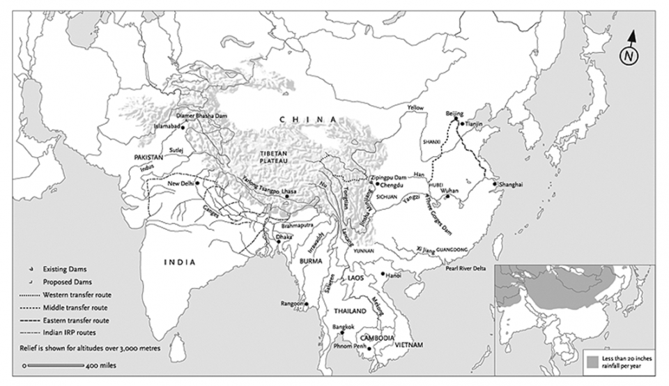
Major Waterworks in the Great Himalayan Watershed
Major Waterworks in the Great Himalayan Watershed
© New Left Review.
Originally published in Pomeranz, Kenneth. “The Great Himalayan Watershed: Agrarian Crisis, Mega-Dams and the Environment.” New Left Review 58 (2009): 5–39.
Used by permission.
The copyright holder reserves, or holds for their own use, all the rights provided by copyright law, such as distribution, performance, and creation of derivative works.

The Yangzi River basin.
The Yangzi River basin.
Map by Cncs.
Accessed via Wikimedia on 8 May 2019. Click here to view source.
 This work is licensed under a Creative Commons Attribution-ShareAlike 3.0 Unported License.
As the longest river in China, the Yangzi river runs through an area that is inhabited by approximately one-third of China’s population, and is one of the most agriculturally productive. Historically, while the Yellow River was conceived of as a political symbol and closely associated with the rise and fall of imperial dynasties, the Yangzi River was to a large extent managed with minimal intervention from the state and was in the hands of local communities.
However, water management in the Yangzi Valley became increasingly contested towards the end of the nineteenth century. With the expanding population and rocketing demand for land, conflicts over land and water resources continuously broke out. As a result, collective dike management became more and more difficult—combined with wars and a lack of funds, the hydraulic systems of central China at the turn of the twentieth century were nearing the brink of collapse. After the Nationalist government settled into Nanjing in 1927, it put a top-down water-system reconstruction project at the top of its list of plans for economic and political revival. The main goal of the reconstruction was to unify the water system nationwide based on watersheds.

Hankow Floods in 1931.
Hankow Floods in 1931.
Unknown photographer, 1931.
Accessed via Wikimedia on 8 May 2019. Click here to view source.
 This work is licensed under a Creative Commons Public Domain Mark 1.0 License.
The hydraulic reconstruction was expedited by a catastrophic flood in 1931 that claimed up to four million lives in the central Yangzi Valley. In the same year as the flood, hydrologist Zhang Zili wrote to the Nationalist government, “Improving water control, focusing on the agricultural production, and increasing the industrial output shall be the ultimate goal of the government…” and in order to achieve those goals, “unifying the water-control administration is a most important first step” (Shuili yuekan, issue 1, no. 1, 1931). For illustration Zhang turned to the case of Hubei to emphasize the importance of unifying the water-control administration: “In terms of financial resources for water control, Hubei province has the most. The resources all come from the dike fees and donations from local people … However, the dike work was either a passive prevention or a make-up strategy—it did not solve the problem. The water problem of Hubei is the water problem of the whole middle Yangzi region; it won’t achieve the best result if we manage all the areas separately” (Shuili yuekan 1931). His statement started a whole new step towards watershed management in the Yangzi Valley.
The first effort made by the Nationalist government was to establish the National Water Control Commission as the highest authority of water control nationwide. It was directly under the Central Administration Department and was jointly administered by the Departments of Internal Affairs, Transportation, Industries, the Navy, and Railways. The second step was to divide the whole nation into water-control zones based on the boundaries of natural watersheds and to establish an effective water-control administrative hierarchy linking water-control zones to the central government. In Zhang’s proposal, the whole nation was divided into eight water-control regions: the Northeast Region, the Shuohai Region, the Yellow River Region, the Huaihe Region, the Yangzi Region, the Donggang Region (the lower Yangzi region), and the Zhujiang Region. He asserted that the rule of division should be based on a combination of hydraulic science, administrative convenience, and financial feasibility.

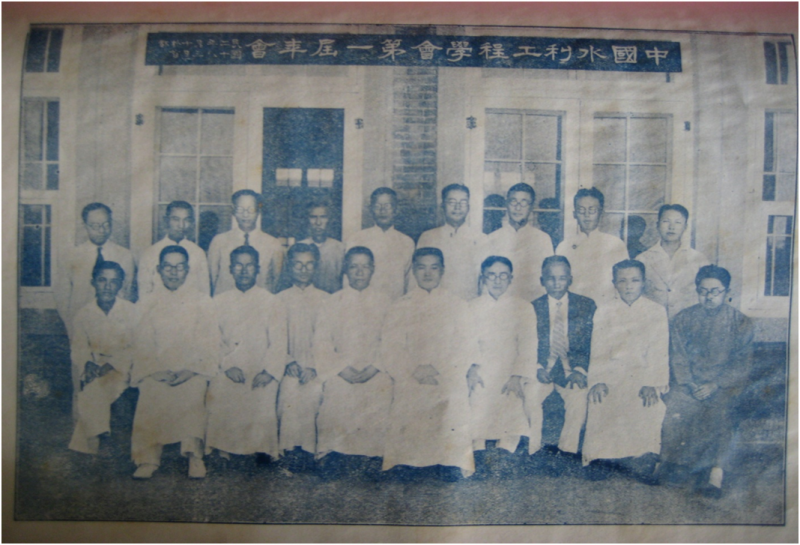
The first annual meeting of the Chinese Association of Hydraulic Engineering (1931).
The first annual meeting of the Chinese Association of Hydraulic Engineering (1931).
Unknown photographer.
Originally ublished in Shuili yuekan 1, no. 5 (1931): 409.
Courtesy of Wuhan University Old Library.
 This work is licensed under a Creative Commons Public Domain Mark 1.0 License.
Zhang’s proposal was well received by the hydraulic-engineering community of the Nanjing Regime. In May of 1931, the China Hydraulic Engineering Association was established. In March of 1932, the association had its first annual meeting. The meeting suggested an effective organizational system between the central government and the local water management—the central government should lead the local water management and the local water management should comply with the central government’s policies. It emphasized again that the water management should be based on watersheds instead of administrative boundaries, such as provinces. In 1932, the Nationalist government started a preliminary investigation into the possibility of a dam in the Three Gorges, which was initially proposed by Sun Yat-sen in 1919. In 1935, a Yangzi River Control Commission was established by combining three committees—the Yangzi River Course Committee, the Taihu Area Water Control Committee, and the Xiang’e’hu’jiang Hydromorphology Station. Unfortunately, as the Sino-Japanese war broke out in 1937, many of the Yangzi River projects were halted. The water-system reconstruction resumed on a small scale after World War II but was abandoned again due to the Civil War. The blueprint of a unified Yangzi watershed-management system was not revived until some time during Mao’s regime.
Today the Chinese state has played a central role in megaproject constructions, damming the Yangzi and transferring water from Yangzi to the North and Northwest (South-North Water Transfer Project). The centralizing scheme of watershed management about a century ago was more than a historical phantom that built state power through ecological reorganization.

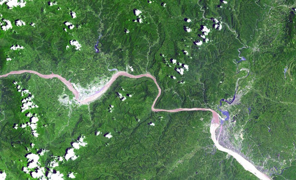
This ASTER image shows a 60 km stretch of the Yangzi river in China, including the Xiling Gorge, the most easterly of the three gorges. In the left part of the image is the construction site of the Three Gorges Dam, the world’s largest dam.
This ASTER image shows a 60 km stretch of the Yangzi river in China, including the Xiling Gorge, the most easterly of the three gorges. In the left part of the image is the construction site of the Three Gorges Dam, the world’s largest dam.
Courtesy of ASTER and NASA.
 This work is licensed under a Creative Commons Public Domain Mark 1.0 License.
How to cite
Yan Gao. “Unifying the Yangzi Watershed in Early Twentieth-Century China.” Environment & Society Portal, Arcadia (Summer 2019), no. 28. Rachel Carson Center for Environment and Society. doi.org/10.5282/rcc/8747.
ISSN 2199-3408
Environment & Society Portal, Arcadia
 This work is licensed under a Creative Commons Attribution 4.0 International License.
2019 Yan Gao
This refers only to the text and does not include any image rights.
Please click on an image to view its individual rights status.
- Gao, Yan. “‘The Revolt of the Commons’: Resilience and Conflicts in the Water Management of the Jianghan Plain in Late Imperial China.” Resilience: A Journal of Environmental Humanities 3, Environmental Humanities from Below (Winter/Spring/Fall 2015–2016): 34–70.
- Marks, Robert B. China: Its Environment and History. Lanham: Rowman & Littlefield, 2012.
- McCormack, Gavan. “Water Margins: Competing Paradigms in China.” Critical Asian Studies 33, no.1 (March 2001): 5–30.
- Shapiro, Judith. China’s Environmental Challenges. Cambridge: Polity Press, 2012.
- Shuili yuekan 1, no. 1 (1931).
- Van Slyke, Lyman P. Yangtze: Nature, History, and the River. Boston: Addison-Wesley Publishing Company, Inc., 1988.
- Yangzi River Watershed Planning Office. Changjiang shuili shilue [A history of the Yangzi River management]. Beijing: Shuili dianli chubanshe, 1979.


