Toward the end of the medieval era and during the early modern era, north Atlantic coastal areas in Portugal, France, Belgium, and England were affected by windblown sands moving from the ocean to inland areas. This is documented in several works concerning the Gascony coasts, the mouth of the Gironde (Soulac), the Oleron and Arvert islands, Escoublac, and Britanny, as well as northwest Europe.

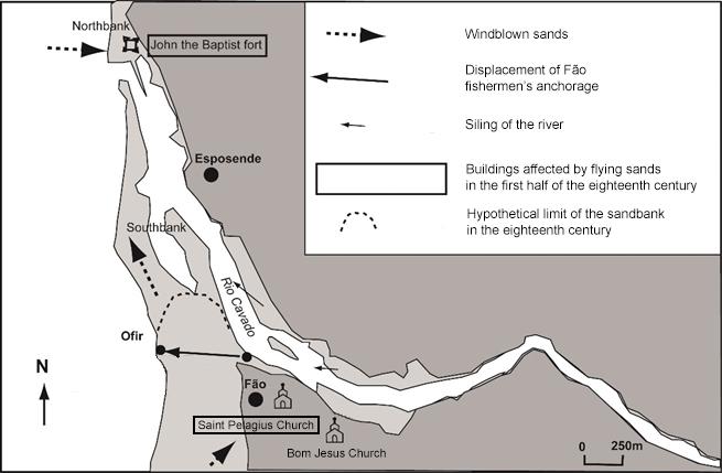
Sandbank at the Cávado river mouth (Ofir, Fão).
Sandbank at the Cávado river mouth (Ofir, Fão).
Photograph by Francisco Restivo, 2017.
Accessed via Flickr on 22 July 2020. Click here to view source.
 This work is licensed under a Creative Commons Attribution 2.0 Generic License.
At the end of the medieval period, some localities in Portugal were destroyed (Aster, Santa Maria das Areias, and Fão) forcing populations to migrate, and there were similar situations in Brittany during the eighteenth century. In Fão, in northwest Portugal, on the south bank of the Cávado river mouth, a sandstorm (areosa) completely covered and destroyed the medieval church and necropolis at the end of the fourteenth century, and during the nineteenth century, were known as areias impelidas pelo vento (literally “wind-driven sands”). During these five centuries, there were periods when this phenomenon (of sands carried by the north winds) occurred with greater or lesser intensity, and it affected the southern banks of Portuguese river mouths or deforested coasts. The period between 1700 and 1750 seems to have been a moment when the problem became more complicated, as referenced in descriptions of the Portuguese central coast and Brittany.
The causes of this high sedimentation were strong north winds and violent storms, combined with deforestation that originated in the overexploitation of forests for domestic, commercial, and industrial uses (i.e., shipbuilding).
Between 1706 and 1712, Carvalho da Costa, a scholar of history, geography, and astronomy, described Fão as a sandy place that was previously not so affected by sands. At the mouth of the Cávado River and on the French Atlantic coast, sands altered and degraded the physical environment: buildings were destroyed, the silting of the Cávado river mouth worsened, and agricultural fields became sterile.
Map of the Cávado river mouth.
Map of the Cávado river mouth.
Map by Sébastien Périsse, 2020.
Modified by Jonatan Palmblad.
 This work is licensed under a Creative Commons Attribution 4.0 International License.
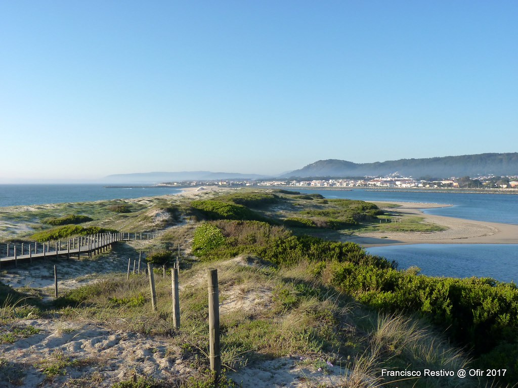
The Fort of St. John the Baptist, in the village of Esposende (on the north bank of the Cávado river mouth), was one of the buildings most affected by windblown sands. It was built between 1699 and 1702, and four years later was completely degraded; the fast-accumulating sands reached as high as its wall. In front of this fort, on the other side of the river, Fão parish church—which had been cyclically destroyed by sands since 1586—was so immersed in sand that it was said that goats could graze on the roof. Some strategies adopted to defend this church included placing the entrance on the opposite side from the ocean, as happens in other locations in northern Portugal, and building walls. In 1734, the parish church was in complete ruin and there were no resources to restore it, because alms were directed to another church (Bom Jesus Church). On the Portuguese central coast (Mira and Lavos), populations decided to move their churches and rebuilt them further inland.
Saint Pelagius Church and the Fort of St. John the Baptist were particularly badly affected because they were the closest to the sea and, during 1700–1750, there was a great absence of vegetation that could have defended buildings against windblown sands.

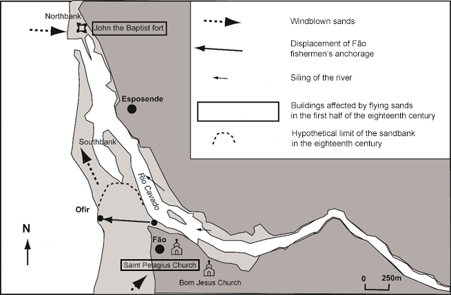
The Parish church of St. Pelagius was destroyed several times by sands.
The Parish church of St. Pelagius was destroyed several times by sands.
Photograph by Ana Isabel Lopes, 2019.
This work is licensed under a Creative Commons Attribution 4.0 International License.
Another consequence of the “flying sands” was that the silting of the Cávado river mouth became worse. Diogo Vilas Boas Sampaio, informing Jerónimo Contador de Argote about the Cávado River, says that around 1732–1734, the peasants who cultivated riverbanks saw sailing boats on the river transporting goods and people. Before 1730, the riverbed had been deeper, and they had not even seen the masts of the boats. The river-mouth morphology seems to have been changing in this period and was undergoing an increasing and accelerated silting up, mainly on the south bank. António Carvalho da Costa, in 1706–1712, and Luís Caetano de Lima (author of a Portuguese historical geography), in 1736, claim that on the north bank, in Esposende port, it was only possible for caravels and small boats to anchor. Also, the silting of the river made it difficult for Fão fishers, who did not have their own port, to anchor. They were forced to land on Ofir beach, about two kilometers from the village.
Thirdly, accumulated sands in agricultural fields decreased their productivity. In the seventeenth century, sand accumulation in Santa Casa da Misericórdia de Fão’s fields led to migration or to a preference for the cheaper Ducal House of Braganza’s fields. The same happened on the coast of northwestern France, in the eighteenth century, where tumultuous winds deprived parishes of linen.

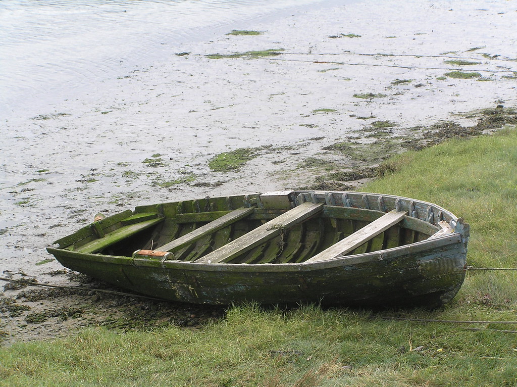
Beached boat at the Cávado river mouth.
Beached boat at the Cávado river mouth.
Photograph by Francisco Restivo, 2009.
Acccessed via Flickr on 22 July 2020. Click here to view source.
This work is licensed under a Creative Commons Attribution 2.0 Generic License.
The alteration and degradation of the landscape led to, in the middle of the eighteenth century, a demand by the people of Fão for a wine tax of up to a total of 4,000 cruzados, with the aim of erecting wooden defenses for buildings (sebes) near the Atlantic Ocean and the Cávado River, in order to prevent the incursion of sands, such as had happened in the late sixteenth century and throughout the seventeenth century.
This “flying sands” phenomenon, which has been studied in recent years in the north Atlantic, offers a possible explanation for people’s fear of the coast (in addition to piracy, shipwrecks, and the violence of the sea waves). From the second half of the nineteenth century, “flying sands” seem to have been less frequent on the north and central Portuguese coasts, leading inland populations to settle in coastal areas, temporarily or permanently, to take advantage of maritime resources.
How to cite
Lopes, Ana Isabel. “The Consequences of ‘Flying Sands’ in the Cávado River Mouth (1700–1750).” Environment & Society Portal, Arcadia (Summer 2020), no. 27. Rachel Carson Center for Environment and Society. https://doi.org/10.5282/rcc/9073.
ISSN 2199-3408
Environment & Society Portal, Arcadia
This work is licensed under a Creative Commons Attribution 4.0 International License.
2020 Ana Isabel Lopes
This refers only to the text and does not include any image rights.
Please click on an image to view its individual rights status.
- Lopes, Ana Isabel Alves. “‘Governar a natureza’: o assoreamento da foz do rio Cávado, em Fão – causas, impactos e respostas sociais (1750–1870).” Master’s diss., University of Porto, 2019.
- Caillosse, Pierre. “La chapelle du Verdon en Médoc face à la menace des sables dans les années 1730–1750: sources écrites et mobilités des sables.” In L’environnement en mémoire. Marqueurs, outils et perspectives, edited by Anne Bardot-Cambot and Laurence Tranoy, 97–194. Rennes: Presses Universitaires de Rennes, 2015.
- Charpentier, Emmanuelle. “Les sociétés littorales face aux ‘sables volages’: le cas du Léon (Bretagne), fin XVIIe–XIXe siècle. ” In Le paysan et la mer: Ruralités littorales et maritimes en Europe au Moyen Âge et à l'Époque Moderne, edited by Jean-Luc Sarrazin and Thierry Sauzeau, 227–246. Toulouse: Presses Universitaires du Midi, 2020.
- Costa, António Carvalho da. Corografia portugueza, e descriçam topografica do famoso reyno de Portugal. Lisboa: na officina de Valentim da Costa Deslandes impressor de Sua Magestade, & á sua custa impresso, 1706–1712.
- Argote, J. Contador de. Memórias para a História Eclesiástica do Arcebispado de Braga, Primaz das Hespanhas. Lisboa: na officina de Joseph Antonio da Silva, 1732–1734.
- Lima, Luís Caetano de. Geografia Histórica de Todos os Estados Soberanos. Lisboa Occidental: na officina de Joseph Antonio da Silva, 1734–[1736].
- Bateman, Mark D., and Steven P Godby. “Late Holocene Inland Dune Activity in the United Kingdom: A Case Study from Breckland, East Anglia.” The Holocene 14 (2004): 579–88.


