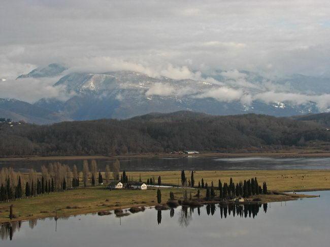
Cape Pitsunda is located in present-day Abkhazia, formerly part of the Georgian Soviet Socialist Republic, on the shores of the Black Sea. In the 1960s, the resort town of Pitsunda was built on the eastern side of the peninsula, between its southern point and the mouth of the Bzyb River. The group of residential and office buildings was built as close as possible to a concrete embankment protecting them from the sea. Pitsunda’s pine forests and mild climate made it an ideal resort. However, in January 1969, a storm broke out; it lasted 80 hours, damaged the sea wall, flooded the ground floor of the residential buildings, and washed away the shingle beach. A month later, another storm completely demolished the concrete embankment, since the beach no longer offered any protection.

Map of Abkhazia showing the Bzyb River and its mouth near Pitsunda.
Map of Abkhazia showing the Bzyb River and its mouth near Pitsunda.
Click here to view UN source.
This is a wikimedia commons map derived from products of the United Nations Cartographic Section. Modified versions of UNCS maps may be used provided that the UN name and reference number does not appear on any modified version and a link to the original map is provided.
 This work is licensed under a Creative Commons Public Domain Mark 1.0 License.
As subsequent research has shown, the original mistake of the resort’s creators was to situate the buildings too close to the coastline without anticipating the storms that frequently occur on the Black Sea. The second crucial mistake was the construction of a sea wall with a strictly vertical front face. This model was used in Baltic resorts but was unsuitable for the Black Sea. The sea floor near Cape Pitsunda rises at an angle of 30 degrees, and the waves do not die down in the shallows as they typically do in the Baltic. The storm surge accelerates in the depths, hits the vertical sea wall, and gushes over it. This inevitably damages the sea wall, as well as it forming a funnel that carries away the shingle and destroys the beach. In order to prevent a repetition of the catastrophe of 1969, and to understand the full range of causes behind the destruction of the beach, a research team was formed under the leadership of V. P. Zenkovich, head of the Laboratory of Sea Shelves and Coasts of the oceanological and geographical institutes of the Soviet Academy of Sciences, as well as A. Kinkadze, head of laboratory at the geographical institute of the Georgian Soviet Socialist Republic’s Academy of Sciences. As the researchers already knew, the beaches of Cape Pitsunda are formed by sediment carried by the Bzyb River. The researchers discovered that submarine canyons stretch from the far depths to the coast; one of these canyons is directly opposite the now-destroyed beach. The hypothesis was advanced that pebbles from the beach flow into these canyons. This hypothesis was proven correct with the aid of fluorescent sand tracers. However, the volume of material flowing into the canyons was small and could not be the cause of beach erosion. A study of the canyon facing the source of the river led to the same conclusion.

View of Cape Pitsunda after the coastal reconstructions.
View of Cape Pitsunda after the coastal reconstructions.
2007 Olga Kozina
Click here to view Wikimedia source.
 This work is licensed under a Creative Commons Attribution-ShareAlike 2.5 Generic License.
The research team then began a closer study of the beach itself. They found that the erosion had exposed the layers of clay at beneath the shingle. These were quickly destroyed once the shingle was gone. They also noticed that the coast on the other side of the river was not only unaffected by erosion, it was even continuing to grow outwards into the water. The cause was found in the mouth of the Bzyb River, which had previously been used for industrial pebble quarrying. After one storm, the river changed course and began to wash away the open-cast mines; one side was therefore reinforced with a concrete wall. As a result, the shingle and sand that made up the beach and protected the coast from erosion washed away only on one side. The clay of the Pitsunda beach slowly lost its protective layer; the storm of 1969 only finished a process that human beings had unknowingly begun. In the 1980s, the Pitsunda beach was reconstructed with the help of specially imported gravel and sand. The long story of the reconstruction shows the destructiveness of unthinking human interference in a complex natural system.
How to cite
Yakushenko, Olga. “The 1969 Flood and Coastal Erosion on Cape Pitsunda.” Environment & Society Portal, Arcadia (2014), no. 13. Rachel Carson Center for Environment and Society. https://doi.org/10.5282/rcc/6291.
ISSN 2199-3408
Environment & Society Portal, Arcadia
 This work is licensed under a Creative Commons Attribution-NonCommercial-ShareAlike 3.0 Unported License.
2014 Olga Yakushenko
This refers only to the text and does not include any image rights.
Please click on the images to view their individual rights status.
- Menshikov, V. L., and V. M. Peshkov. Bereg Pitsundy: Fakty i gipotezy. Moscow: Mysl’, 1980.
- Zenkovich, V. P. “Geomorphological Problems of Protecting the Caucasian Black Sea Coast.” The Geographical Journal 139 (October 1973): 460–66.
- Zenkovich, V. P., and M. Schwartz. “Protecting the Black Sea-Georgian S.S.R. Gravel Coast.” Journal of Coastal Research 3 (Spring 1987): 201–9.


