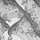
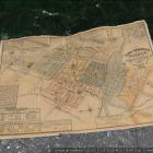
Cartografía histórica
Cartografía histórica
Los mapas son representaciones más políticas que objetivas sobre un lugar. Al seleccionar y codificar algunas piezas de información, mientras se silencian otras, los mapas funcionan como discursos políticos y son usados como “órdenes de marcha” para construir geografías.
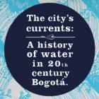
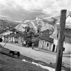
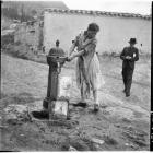
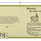
Las corrientes de la ciudad: Una historia del agua en la Bogotá del siglo XX
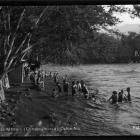
Esta exposición explora el rol del agua en la lucha de Bogotá, capital de Colombia, por convertirse en una ciudad moderna. Para Bogotá, cumplir con los estándares de los higienistas y la élite gobernante fue una tarea de control social, tecnológico y ambiental. Esta exposición examina experiencias cotidianas del agua como el lavado de la ropa o la limpieza del cuerpo, al mismo tiempo que estudia intervenciones de infraestructura urbana que incluyeron la domesticación de los ríos para el abastecimiento de agua potable y la evacuación de aguas residuales.
Stefania Gallini, Laura Felacio, Angélica Agredo y Stephanie GarcésAbout the author