
Arcadia
Blood in the Water: A Digital History Project on the Geography of Pontiac’s War, 1763
Digital tools reveal a geographic logic to the violence of Pontiac’s War.
Digital tools reveal a geographic logic to the violence of Pontiac’s War.
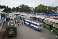
This article investigates the transformation of Bangalore’s Dharmambudhi lake into the central bus terminus.
This article examines early twentieth-century China’s top-down scheme of managing rivers based on watershed.
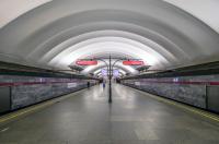
A flooding in the Saint Petersburg metro divided the city into two parts for nearly a decade.
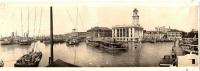
This article rethinks the environmental history of water and power in Copiapó between 1744 and 1801.
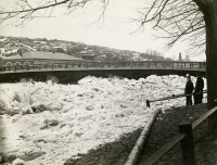
Historical documents provide detailed descriptions of ice-jam flood events and climate impacts in riverine communities.
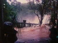
José Paronella’s dream continues at Paronella Park despite catastrophic flood and cyclonic events.
Could the Crooked Creek Flood of 1846 be the reason we cannot find George DeBaptiste’s house?
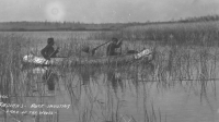
This article explores the intersection of water management, manomin, and food insecurity for an Anishinaabe community in Northwestern Ontario.
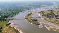
Nijmegen’s “Room for the Waal” project is a leading example for the application of the “making room for the river” water management approach.