Arcadia
Ukraine and Camels: Features of the Incorporation into the Steppe Landscape
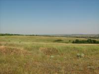
This Arcadia article is about how camels used, until recently, to be a central feature of the steppe landscape of Southern Ukraine.
This Arcadia article is about how camels used, until recently, to be a central feature of the steppe landscape of Southern Ukraine.
Carter et al. translate key themes from scenario narratives into spatial representations using Geographic Information Systems (GIS). They apply this technique to a Tasmanian case study exploring future scenarios for biodiversity in a predominantly privately-owned agricultural landscape, enabling land managers to explore outcomes from potential interventions and identify strategies that might mitigate the impact of future issues of environmental concern.
In this exhibition, ENHANCE ITN doctoral researchers showcase short virtual reality video installations that emerged out of their own empirical and ethnographic fieldwork. The videos work by tracking, rendering, and displaying full-field visual, sonic, and tactile data in a context in which the viewer has full control and is empowered to decide what to look at, listen to, and feel—or which story to experience.