Copyright information
“Drought, Mud, Filth, and Flood: Water Crises in Australian Cities, 1880s–2010s” was created by Andrea Gaynor, Margaret Cook, Lionel Frost, Jenny Gregory, Ruth Morgan, Martin Shanahan, Peter Spearritt, Susan Avey, Nathan Etherington, Elizabeth Gralton, and Daniel Martin (2019) under a Creative Commons Attribution 4.0 International license. This refers only to the text and does not include image rights. Please click on an image to view its individual rights status. Thumbnails of the following images appear on the exhibition landing page:

2019 Nathan Etherington.
 This work is licensed under a Creative Commons Attribution 4.0 International License.

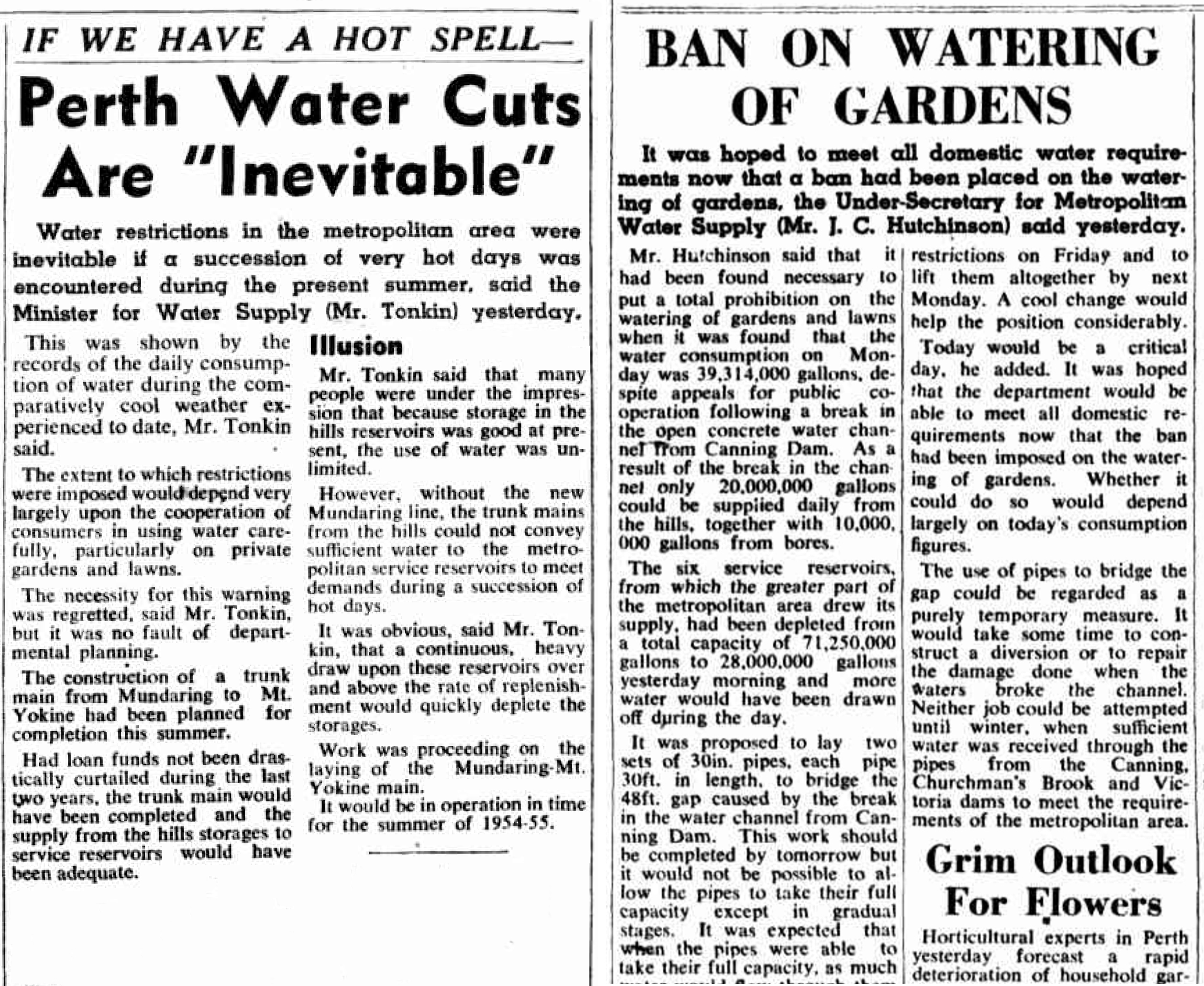
Snippets from front pages of The West Australian from the early 1950s, a time of frequent water restrictions. The West Australian, 17 December 1953 and 18 January 1950.
Snippets from front pages of The West Australian from the early 1950s, a time of frequent water restrictions. The West Australian, 17 December 1953 and 18 January 1950.
Courtesy of Trove, National Library of Australia.
Click here and here to view sources.
 This work is licensed under a Creative Commons Public Domain Mark 1.0 License.
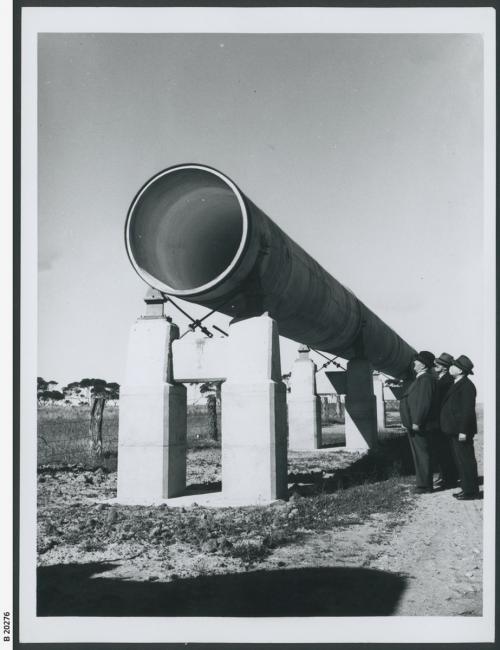
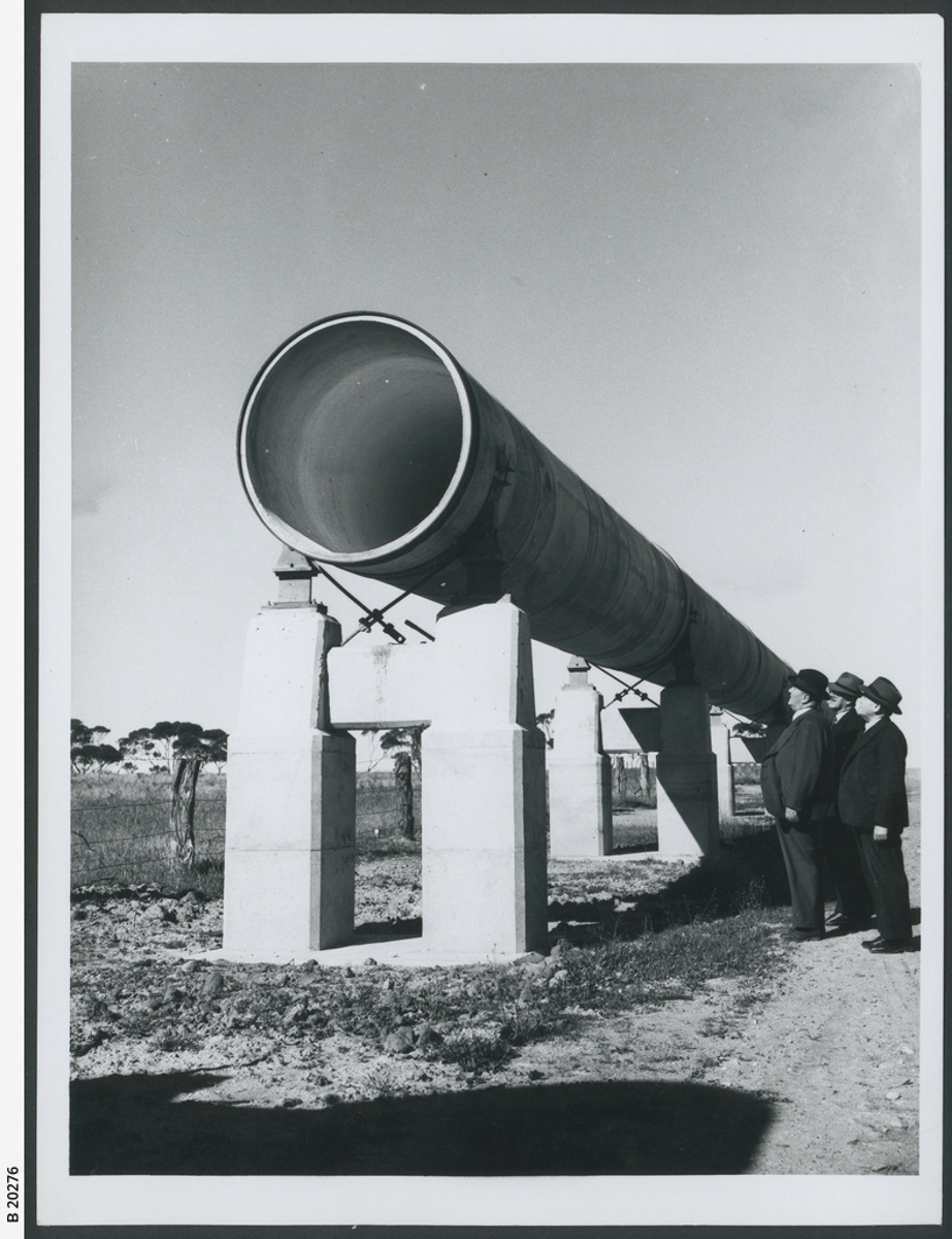
Mannum-Adelaide pipeline under construction. Completed in 1955, the pipeline connected Adelaide to Murray River. Unknown photographer, 1953.
Mannum-Adelaide pipeline under construction. Completed in 1955, the pipeline connected Adelaide to Murray River. Unknown photographer, 1953.
Courtesy of State Library of South Australia. Image B 20276. Click here to view source.
This work is licensed under a Creative Commons Public Domain Mark 1.0 License.

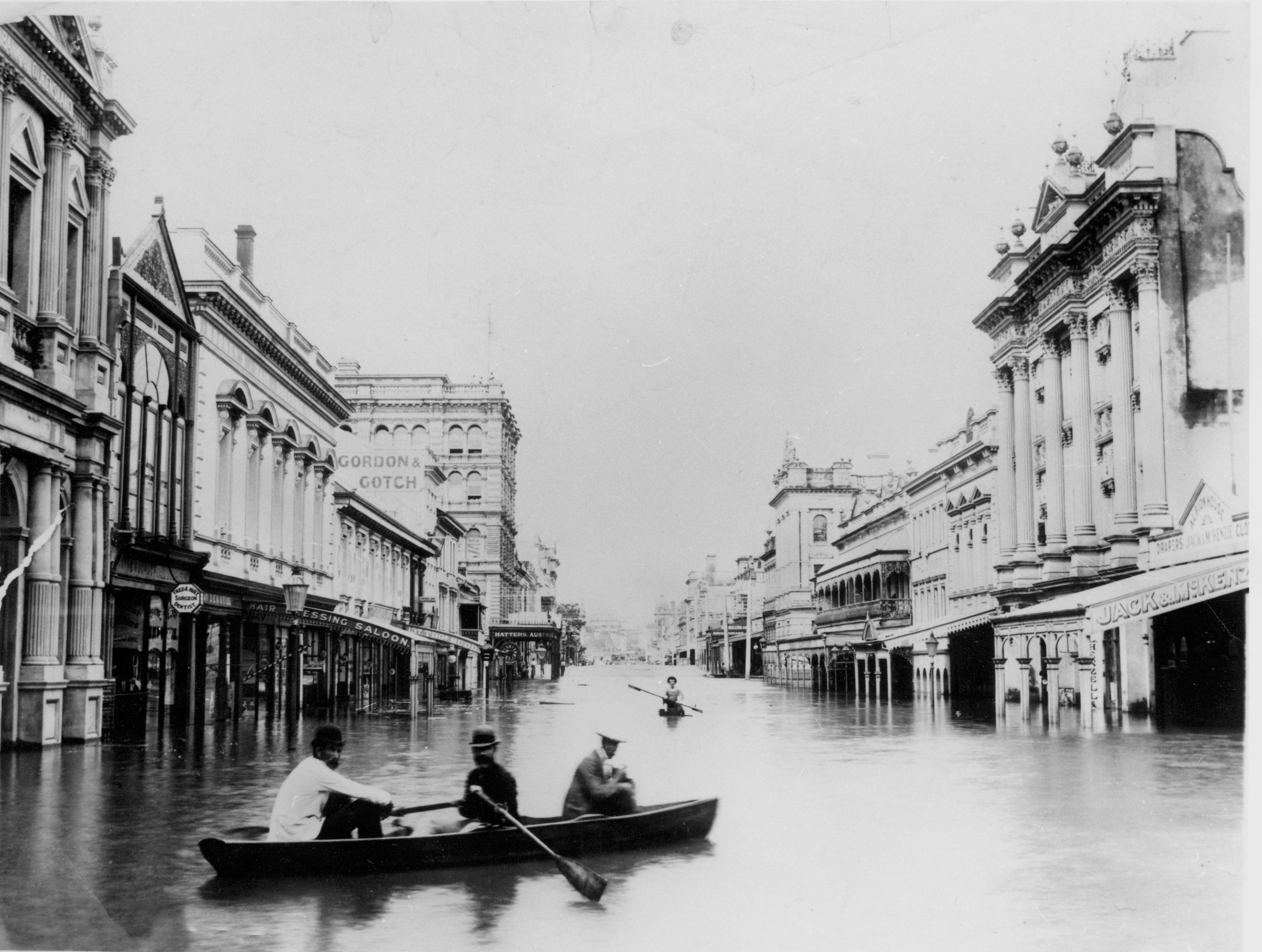
Brisbane is flooded by the second and third highest recorded floods within a fortnight. Unknown photographer, 1893.
Brisbane is flooded by the second and third highest recorded floods within a fortnight. Unknown photographer, 1893.
Courtesy of the State Library of Queensland. Image 84890. Click here to view source.
This work is licensed under a Creative Commons Public Domain Mark 1.0 License.

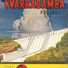
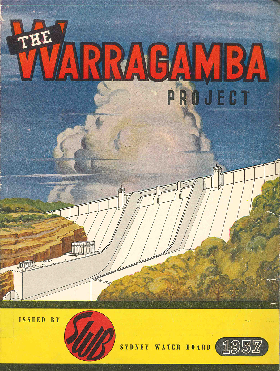
Artist’s impression of the Warragamba Dam published with Sydney Water Board promotional material in 1957. Unknown illustrator, 1957.
Artist’s impression of the Warragamba Dam published with Sydney Water Board promotional material in 1957. Unknown illustrator, 1957.
Courtesy of the State Library of New South Wales.
This work is licensed under a Creative Commons Public Domain Mark 1.0 License.

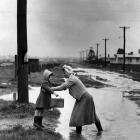
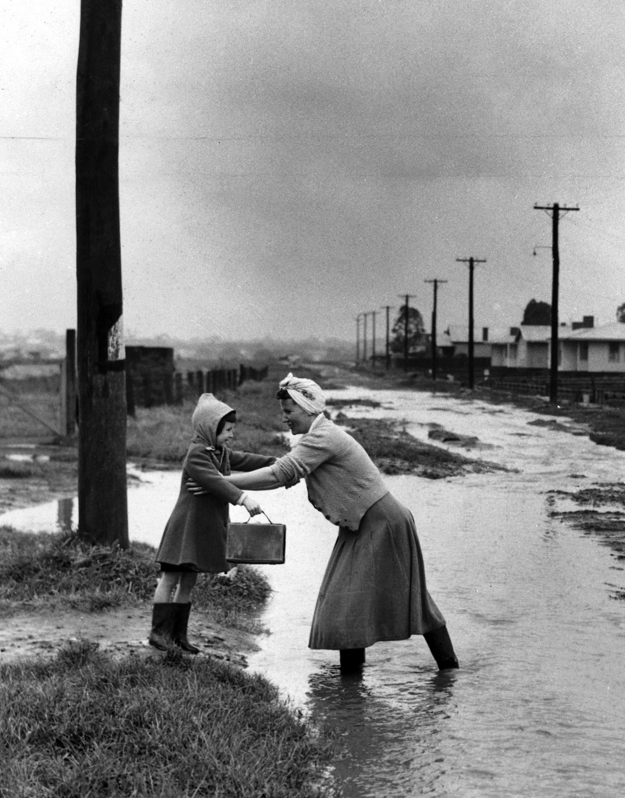
Mrs. J. Asbury gives her daughter Barbara a lift across the flooded drain outside her home in Cuthbert Street, Reservoir in Melbourne, Victoria. Photograph by Len Drummond, 1953.
Mrs. J. Asbury gives her daughter Barbara a lift across the flooded drain outside her home in Cuthbert Street, Reservoir in Melbourne, Victoria. Photograph by Len Drummond, 1953.
Photo courtesy of News Limited.
This work is licensed under a Creative Commons Public Domain Mark 1.0 License.
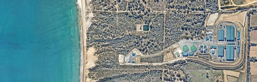
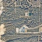
Perth’s Southern Seawater Desalination Plant converts seawater from the Indian Ocean to drinking water, to meet more than half of Perth’s scheme water demand. Photograph by Nearmap Australia Pty Ltd, 2019.
Perth’s Southern Seawater Desalination Plant converts seawater from the Indian Ocean to drinking water, to meet more than half of Perth’s scheme water demand. Photograph by Nearmap Australia Pty Ltd, 2019.
© Nearmap Australia Pty Ltd, 2019.
Used by permission.
The copyright holder reserves, or holds for their own use, all the rights provided by copyright law, such as distribution, performance, and creation of derivative works.

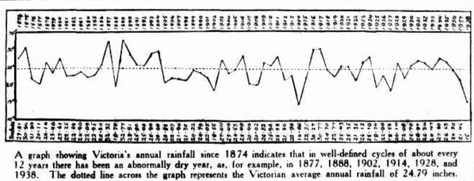
This graph, published in the Argus during the drought of 1938, shows Victoria’s annual rainfall since 1874. Unknown illustrator, ca. 1938.
This graph, published in the Argus during the drought of 1938, shows Victoria’s annual rainfall since 1874. Unknown illustrator, ca. 1938.
Image courtesy of Trove, National Library of Australia.
Click here to view source.
This work is licensed under a Creative Commons Public Domain Mark 1.0 License.
Drought, Mud, Filth, and Flood: Water Crises in Australian Cities, 1880s–2010s
In this exhibition, we invite visitors to consider the historical relationship of “water crises” of various kinds to the development of urban water systems, through the experience of the driest inhabited continent on earth, Australia. We have chosen a range of different departures from water-related business as usual—from shortage to flood, pollution to drainage—in the five mainland Australian state capitals from the late nineteenth century to the present. The part of this exhibition devoted to each city focuses thematically on just one or two kinds of crisis, while the timeline covers a wider range of events in each place.
About the ExhibitionAbout the author


